





vb

twitter linkedinfacebookacp contact us

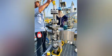
With DIAL, operators can adjust valve settings remotely from the surface. (Image source: Silverwell)

Silverwell has been awarded a multi-million-dollar, multi-well contract with a leading Middle East operator for the deployment of its Digital Intelligent Artificial Lift (DIAL) technology

The programme covers high-production offshore assets, including premium high-rate extended reach drilling (ERD) wells, dual-string completions and auto-gas lift applications.

Optimising gas-lift wells normally requires costly interventions to change valves and collect downhole data. Changing valve settings can mean taking a well offline, replacing the valves and unloading the well, resulting in lost production and high operating costs.

With DIAL, operators can avoid this disruption by adjusting valve settings remotely from the surface, including effective orifice size, in response to changing well conditions. Permanent downhole sensors provide real-time injection rate and temperature data, enabling continuous optimisation without intervention.

The system enables deeper gas injection, higher production rates and lower operating costs, and has proven reliable in high-pressure, acidic environments. DIAL also incorporates Silverwell's Auto-Unloading capability, which automates well start-up and unloading to accelerate production.

"The industry has long treated well intervention as an unavoidable cost of gas lift. It is not," said Darrell Johnson, Chief Executive Officer of Silverwell. "DIAL enables operators to monitor and optimise gas lift performance remotely in real time, boosting production, lowering costs and improving the value of a well over its lifetime."

The award is a strong signal of the growing adoption of all-electric intelligent completions among Middle East operators managing high-rate offshore assets, with offshore exploration and development on the rise in the region, as illustrated by ADNOC's recent US$6.2bn (AED22.6bn) final investment decision (FID) to develop the Umm Shaif Gas Cap in the Umm Shaif and Nasr offshore concession, Kuwait's push to develop three offshore oil and gas fields discovered in 2025 and Aramco' s focus on expanding and maintaining offshore fields with projects such as the Zuluf crude oil increment.

The platform brings live rig data from across drilling operations into a unified, real-time environment. (Image source: SLB)

In a major move illustrating how it is accelerating the deployment of AI at scale throughout its operations, ADNOC has deployed its AI-enabled Real-Time Operations Center (RTOC) across its fleet of more than 120 onshore and offshore drilling rigs, enabled by SLB’s DrillOps intelligent well delivery and insights solutions

The platform brings live rig data from across drilling operations into a unified, real-time environment that gives ADNOC teams greater visibility of activity across the fleet, helping them improve coordination, identify risks and issues earlier and make faster, more informed decisions, thereby managing operations more effectively. The RTOC combines operational data, automated dashboards, advanced analytics and AI-driven insights to turn large volumes of drilling data into clear, actionable information.

Benefits of the deployment

According to ADNOC, the deployment
• Reduces engineering effort by 30% to 40%
• Enables engineers to support two to three times more rigs while maintaining effective oversight
• Enables analyses that previously required a full day can to be completed within minutes,
• Allows reporting cycles that once took several days to be completed within hours
• Reduces incident response times by four to 12 hours
• Helps avoid one to two days of rig downtime.

Through this initiative, ADNOC continues to embed AI into core workflows and accelerate the transition toward more autonomous and optimised operations. It follows the deployment of the first AI-enabled fully automated walking island rig of a six-rig programme for ADNOC Offshore, enabling faster and more consistent offshore well delivery as ADNOC seeks to up production capacity to 5mn bpd by 2027.

Developed in the UAE and hosted within ADNOC's cloud environment, RTOC keeps critical operational data and workflows securely within the country while providing a trusted foundation for AI-driven operations.

Musabbeh Al Kaabi, ADNOC Upstream CEO, said, "The Real-Time Operations Center creates value across ADNOC’s drilling operations every minute by embedding AI into the heart of our drilling operations, helping our teams make faster, smarter decisions at scale. Built securely here in the UAE, it is further proof that ADNOC is moving from AI ambition to real-world impact as we become the world’s most AI-enabled energy company."

“DrillOps transforms real-time drilling data into operational intelligence that helps teams make faster, more informed decisions,” said Rakesh Jaggi, president, Digital, SLB.

“Deployed within ADNOC’s sovereign cloud environment, the technology provides the scalable digital foundation for AI-enabled workflows across one of the industry’s largest rig fleets and supports the continued progression toward more autonomous operations.”

Margarita Kongawoin, senior vice president of software & HPC at DUG Technology, explains how DUG Insight brings the complete geoscience workflow into a single, integrated package – and why that's changing the way teams work

What do you see as the biggest bottleneck in geoscience software today?

Fragmentation seems to be a major issue slowing geoscience teams down. They often have to work with many different software programmes. Moving data between those applications requires data exchange and format conversion, which takes time and can lead to mistakes. When the data reaches the decision-maker’s desk, time (aka money) and attention have been wasted. This fragmented workflow also prevents people from working together and sharing their different skills in a complementary way.

How does DUG Insight overcome those challenges?

DUG Insight provides a single workspace where geoscientists can work together. For interpreters, this means interactive 2D/3D/gather visualisation with tools for fault and horizon picking, well management and manipulation, crossplotting and AI-assisted interpretation. They can also generate attributes including dip and azimuth, semblance, curvature, spectral decomposition and RGB blending, all on demand.

For processing geophysicists, it offers a full suite of time-processing and depth-imaging tools scalable to massive data volumes from any acquisition geometry – land, marine or ocean-bottom node – with dedicated capabilities for time-lapse (4D) and multicomponent data. Users are not required to run heavy batch processes to test a parameter. On DUG Insight, it takes just seconds to test and QC workflows.

QI specialists get the fastest path to rock properties and probabilistic lithology and fluid prediction, with tools from statistical rock physics, to traditional AVA inversion, to our revolutionary elastic MP-FWI imaging technology.

DUG Insight is the only geoscience software package on the market that spans the complete workflow from seismic data processing and depth imaging through to interpretation, visualisation and rock-property prediction – all in a single, integrated package.

ORME Insight image finaljpg

AI is all the buzz now. How does it enhance DUG Insight? What about users who want to bring their own code?

AI tools are now being increasingly integrated into DUG Insight’s workflows for maximum efficiency, whether it’s lithology prediction, fault and horizon interpretation, or accelerated convergence of our MP-FWI.

We also don’t want to lock anyone into a closed box. The software’s API gives users the flexibility to bring their own code into the environment, supporting Java, C/C++, C# and Python. Ultimately, we want to ensure that your custom code is treated with the dignity it deserves. No additional licensing is required, and all intellectual property stays with you.

ORME DUG August 01 reduced

What’s next for DUG Insight?

We’ve got lots of exciting developments coming soon! Our R&D team continues to embed the latest technology, spanning signal processing to interpretation to algorithmic efficiency. For example, we’re now modelling complex acquisition effects like tides, water-column changes, currents and array geometry, which is vital for full-wavefield imaging and for superior time-lapse (4D) results. On land, we’re inverting ground roll to give high-resolution shear-wave velocity, while the new land statics methodology (AMGRT) solves near-surface complexity to correctly position deep targets. Watch this space!

How do real-time monitoring technologies enhance operational safety, asset reliability and environment protection, particularly for large and remote assets such as pipelines?

In an exclusive interview with Oil Review Middle East, Denis Strazding, managing director of Petrofibre Arabia, discusses the company’s role in providing advanced distributed fibre optic monitoring solutions for the oil and gas, energy, and critical infrastructure sectors in Saudi Arabia. He outlines the company's main technologies, such as distributed acoustic and distributed temperature sensing, and how they provide real-time full asset protection, however large or remote the asset may be, enabling precise leak detection and security breach localisation.

“On thousands of kilometres of pipeline, we can pinpoint to one metre exactly where a leak is currently developing, so our partners can deploy their maintenance team with precision to immediately neutralise the leak and prevent the situation deteriorating further,” he explains.

He highlights Petrofibre's commitment to localisation, Saudisation, and local supplier engagement in line with Saudi Vision 2030, noting that 90% of materials are sourced in the Kingdom, important in the current volatile environment.

“The market is full of opportunity,” he says, discussing business prospects.

Strazding concludes by underlining the company’s commitment to innovation and sharing his insights on the potential for future developments in fibre optic sensing. 

"This technology will start opening new doors, and it will become more accurate and sensitive. We'll see new functionalities such as corrosion monitoring.

“I believe the future holds many interesting developments for us, and it is a priority to be at the forefront of these developments, pushing the boundaries of reality,” he says.

Watch the interview here: https://oilreviewmiddleeast.com/adipec-videos/exclusive-interview-with-petrofibre-arabia

The Sigma Enterprises team with the Scout 137 drone. (Image source: ScoutDI)

ScoutDI, the Norwegian manufacturer of the Scout 137 confined space inspection drone system, has entered a new partnership with Sigma Enterprises, a UAE-based provider of industrial products and solutions, boosting access to safe, data-driven confined space inspection across the United Arab Emirates and the wider MENA region

Inspecting tanks, flare stacks, confined spaces and other hazardous and hard-to-access assets remains a major challenge for the oil and gas industry. Increasingly, operators in the MENA region are deploying drone technology for inspections, thereby eliminating the risk to personnel, as well as saving time and costs compared to traditional inspections. Equipped with LiDAR, various sensors, thermal cameras, and high-resolution imaging, drones today can provide accurate and detailed real-time data, precisely pinpointing any threats to asset integrity. Capabilities continue to advance with technology advancements, with the integration of AI and data analytics facilitating real-time data processing and analysis. A recent report projects the drones for oil and gas market to grow from US$1,473.5 mn in 2025 to US$16,755 mn by 2035, recording a compound annual growth rate (CAGR) of 27.5% during this period.

Faster, safer, better inspections

Through the new partnership, Sigma Enterprises brings deep regional presence and technical service capability to industrial clients who need to inspect tanks, vessels and other confined assets without sending people into hazardous spaces. Combined with the Scout 137 drone system, this means faster inspections, better data, and a safer working day for inspection teams across the region's energy, petrochemical and maritime sectors.

The Scout 137 is a tethered drone built for GPS-denied confined spaces. It carries its own lighting, a 4K zoom camera and survey-grade 3D LiDAR, with an optional ultrasonic thickness measurement payload, and it captures every inspection as a positioned, repeatable record in the cloud-based Scout Portal. Because each flight follows a consistent, traceable path, asset owners can compare inspections over time and move toward genuine condition trending rather than one-off snapshots.

“The Middle East is one of the most important regions for industrial inspection, and Sigma Enterprises gives us a strong local partner with the reach and technical depth our customers expect,” said Håvard Eilertsen, chief commercial officer at ScoutDI. “Together we can help the region's asset owners inspect more safely and turn every flight into reliable, comparable data.”

“Adding the Scout 137 to our portfolio lets us offer clients a proven, safer alternative to manual confined space entry,” said a spokesperson for Sigma Enterprises. “It is a natural fit with our mission to bring advanced, reliable technology to industry across the region.”

Both companies will support asset owners across the UAE and MENA with inspection technology that reduces risk, improves data quality and supports long-term asset integrity.

More Articles …