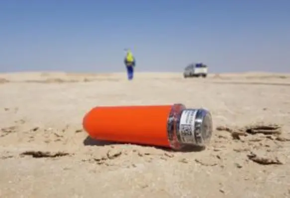
Pioneering seismic technology provider STRYDE has announced an agreement with Africa Geophysical Services LLC, a land seismic data acquisition and processing company in Oman, to supply 154,000 of its nodes for projects in Oman and Africa
The deal is the largest for STRYDE in the Middle East and demonstrates the increasing preference for nodal systems no matter the environmental conditions or size of survey.
Africa Geophysical Services, which has a presence in Oman, India, Tanzania, Egypt, Dubai, Uganda, Turkey and the UK, will use STRYDE’s nodes, expertise and training services to obtain data for oil and gas exploration projects in Oman and Africa.
Its project in Oman, which is due to commence later this year, will see the highest ever number of nodes used for seismic acquisition in the Middle East in any one project – utilising high density acquisition for superior subsurface imaging. Around 130,000 nodes will be deployed via STRYDE’s Compact system, which offers rapid, high-volume charging and data download.
Provision of such high numbers of seismic inventory like this is made possible by the cost effectiveness and efficiency of the STRYDE system. To handle such large inventory in the field, the Compact system will enable up to 13,000 nodes to be prepared in a 24-hour period.
Deploying more nodes creates higher trace density, which produces a much higher definition picture of what lies beneath the ground, enabling oil and gas companies to maximise their existing reservoirs.
Mike Popham, CEO, STRYDE, said, “The oil and gas industry is starting to recognise that high-density seismic imaging is the only option to fully unlock the true value of a reservoir. Our highly reliable nodes, which can be quickly deployed in their tens of thousands, with minimal impact on the environment, offers exactly this; a much better picture for far better returns on reservoirs.”
Salim Ajib Alhajri, chairman, Africa Geophysical Services, added, “This agreement represents a significant moment for both AGS and our customers. Working with the latest acquisition technology we realise our crews can be more efficient, safer and deliver better quality data to our customers, allowing them to radically improve their geological understanding.”


