








Margarita Kongawoin, senior vice president of software & HPC at DUG Technology, explains how DUG Insight brings the complete geoscience workflow into a single, integrated package – and why that's changing the way teams work
What do you see as the biggest bottleneck in geoscience software today?
Fragmentation seems to be a major issue slowing geoscience teams down. They often have to work with many different software programmes. Moving data between those applications requires data exchange and format conversion, which takes time and can lead to mistakes. When the data reaches the decision-maker’s desk, time (aka money) and attention have been wasted. This fragmented workflow also prevents people from working together and sharing their different skills in a complementary way.
How does DUG Insight overcome those challenges?
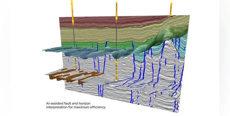
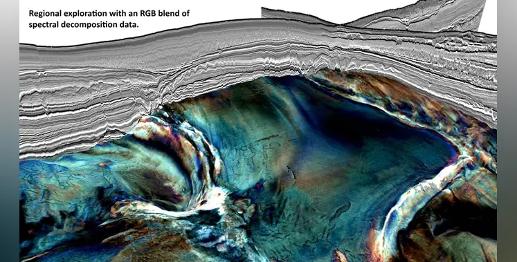
DUG Insight provides a single workspace where geoscientists can work together. For interpreters, this means interactive 2D/3D/gather visualisation with tools for fault and horizon picking, well management and manipulation, crossplotting and AI-assisted interpretation. They can also generate attributes including dip and azimuth, semblance, curvature, spectral decomposition and RGB blending, all on demand.
For processing geophysicists, it offers a full suite of time-processing and depth-imaging tools scalable to massive data volumes from any acquisition geometry – land, marine or ocean-bottom node – with dedicated capabilities for time-lapse (4D) and multicomponent data. Users are not required to run heavy batch processes to test a parameter. On DUG Insight, it takes just seconds to test and QC workflows.
QI specialists get the fastest path to rock properties and probabilistic lithology and fluid prediction, with tools from statistical rock physics, to traditional AVA inversion, to our revolutionary elastic MP-FWI imaging technology.
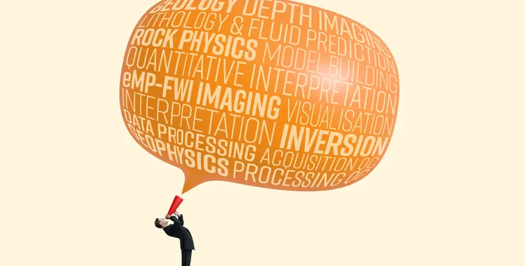
DUG Insight is the only geoscience software package on the market that spans the complete workflow from seismic data processing and depth imaging through to interpretation, visualisation and rock-property prediction – all in a single, integrated package.
AI is all the buzz now. How does it enhance DUG Insight? What about users who want to bring their own code?
AI tools are now being increasingly integrated into DUG Insight’s workflows for maximum efficiency, whether it’s lithology prediction, fault and horizon interpretation, or accelerated convergence of our MP-FWI.
We also don’t want to lock anyone into a closed box. The software’s API gives users the flexibility to bring their own code into the environment, supporting Java, C/C++, C# and Python. Ultimately, we want to ensure that your custom code is treated with the dignity it deserves. No additional licensing is required, and all intellectual property stays with you.
What’s next for DUG Insight?
We’ve got lots of exciting developments coming soon! Our R&D team continues to embed the latest technology, spanning signal processing to interpretation to algorithmic efficiency. For example, we’re now modelling complex acquisition effects like tides, water-column changes, currents and array geometry, which is vital for full-wavefield imaging and for superior time-lapse (4D) results. On land, we’re inverting ground roll to give high-resolution shear-wave velocity, while the new land statics methodology (AMGRT) solves near-surface complexity to correctly position deep targets. Watch this space!
DUG Insight speaks fluent geoscience